
Digital Imaging
LiDAR (an acronym for Light Detection and Ranging) is increasingly becoming a powerful tool for understanding Earth surface processes. Modern LiDAR instruments can pulse at tens of thousands of times per second, producing “point clouds” of millions of individual georeferenced x-y-z points. LiDAR instruments can be mounted on ground-based (tripod) or airborne platforms.
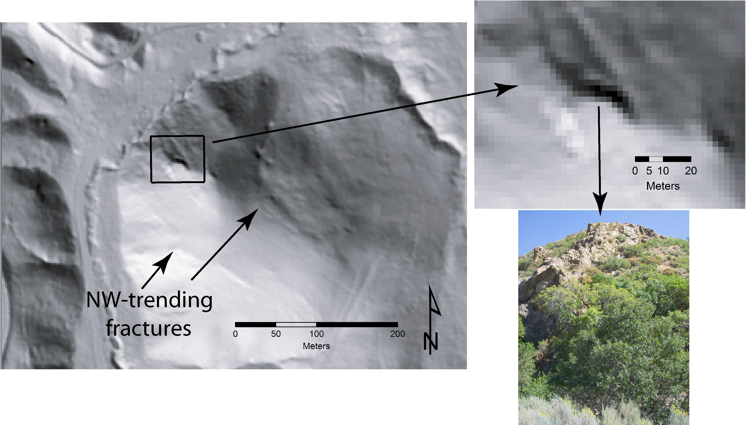
A project funded by the U.S. Geological Survey examined the hypothesis that hydrothermal alteration patterns in rocks (such as those shown below near the Bingham Canyon mining district of the Oquirrh Mountains can be detected using airborne LiDAR.
 |
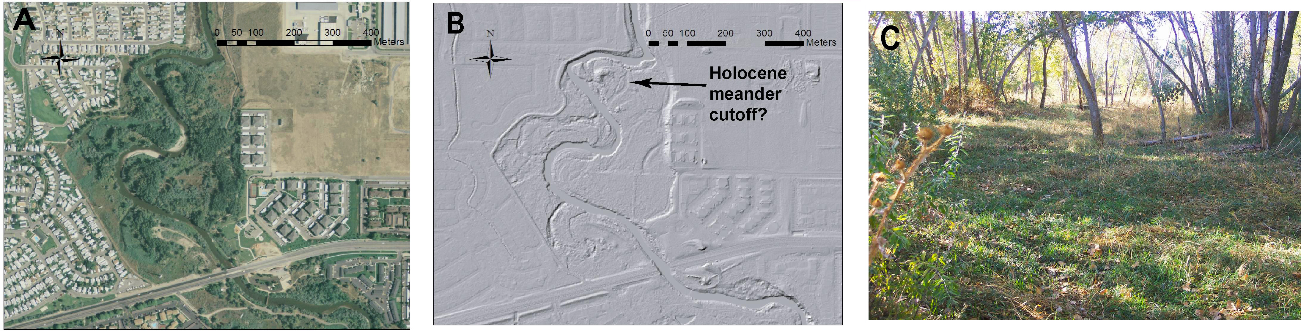
Airborne LiDAR shows a number of very subtle features of the Jordan River system between Utah Lake and the Great Salt Lake of Utah.
 |
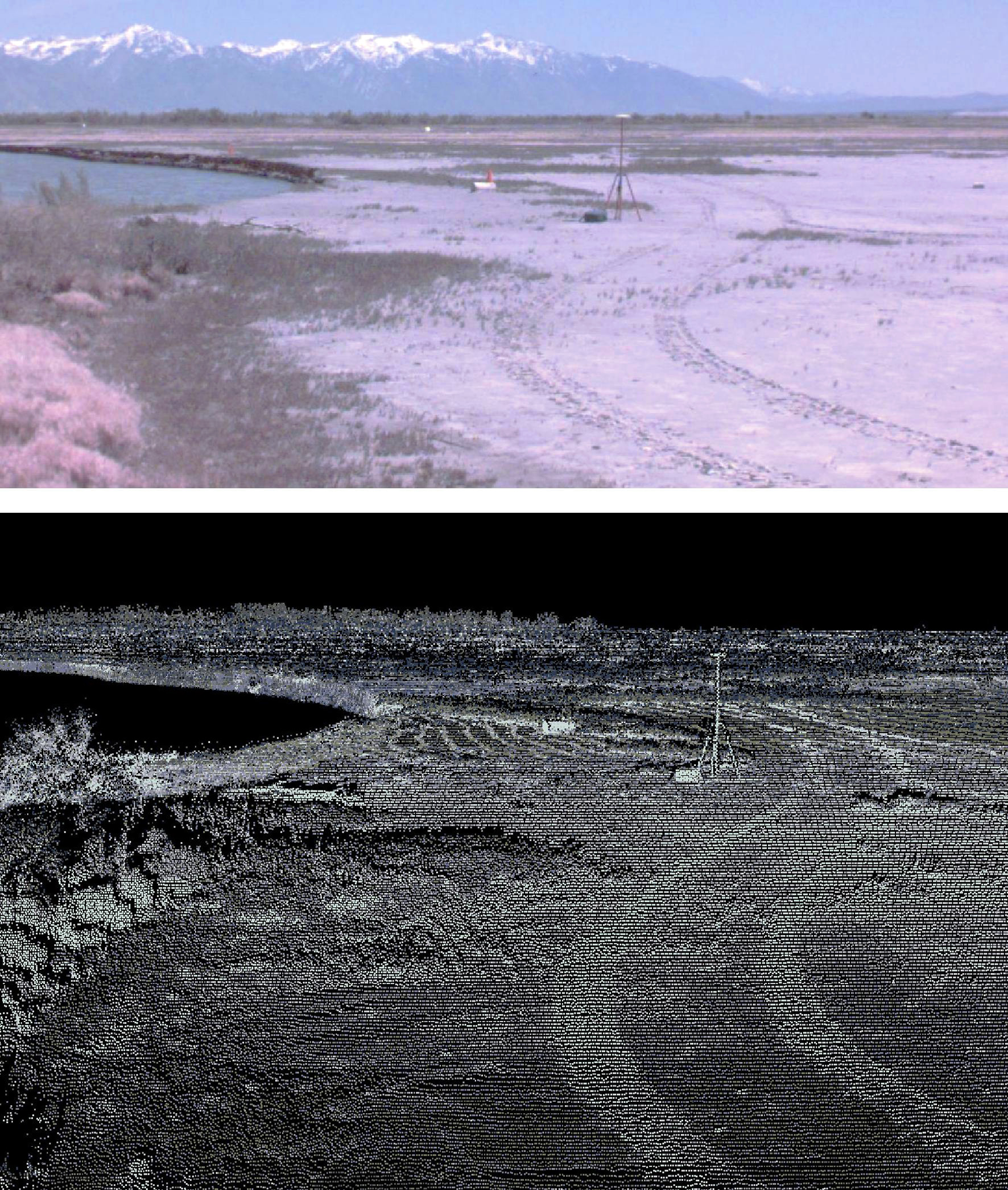
The detail possible with ground-based LiDAR is evident from this photo and point cloud from the Goggin Canal area adjacent to the Great Salt Lake Lake
 |
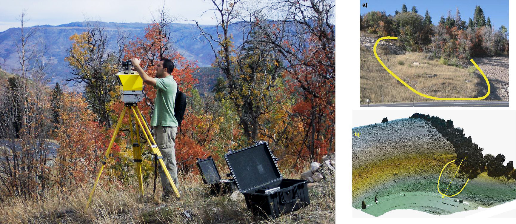
Landslides along the Wasatch Front have been studied with both airborne and ground-based LiDAR surveys.
 |
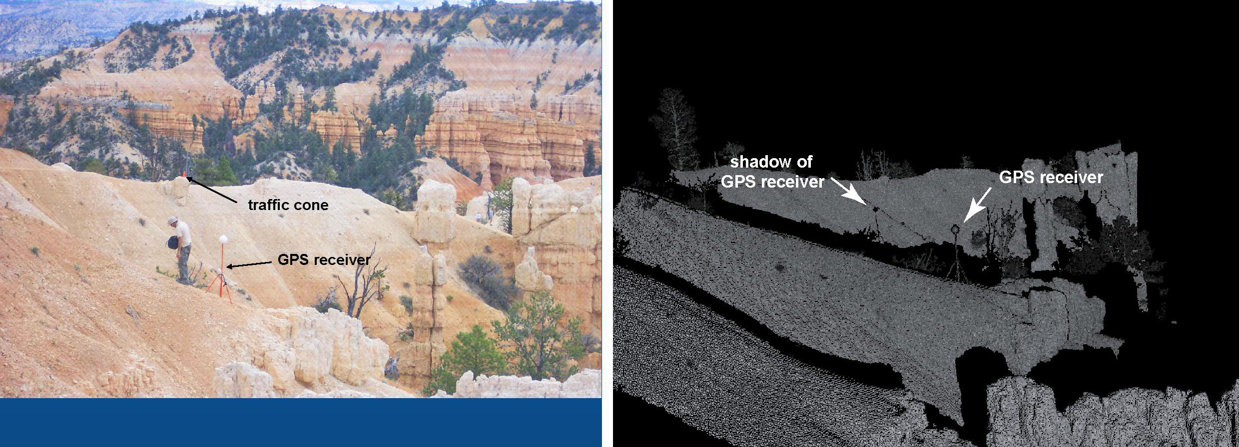
A preliminary ground-based LiDAR survey of selected in Bryce Canyon has been undertaken to understand erosional processes in that spectacular landscape.
 |
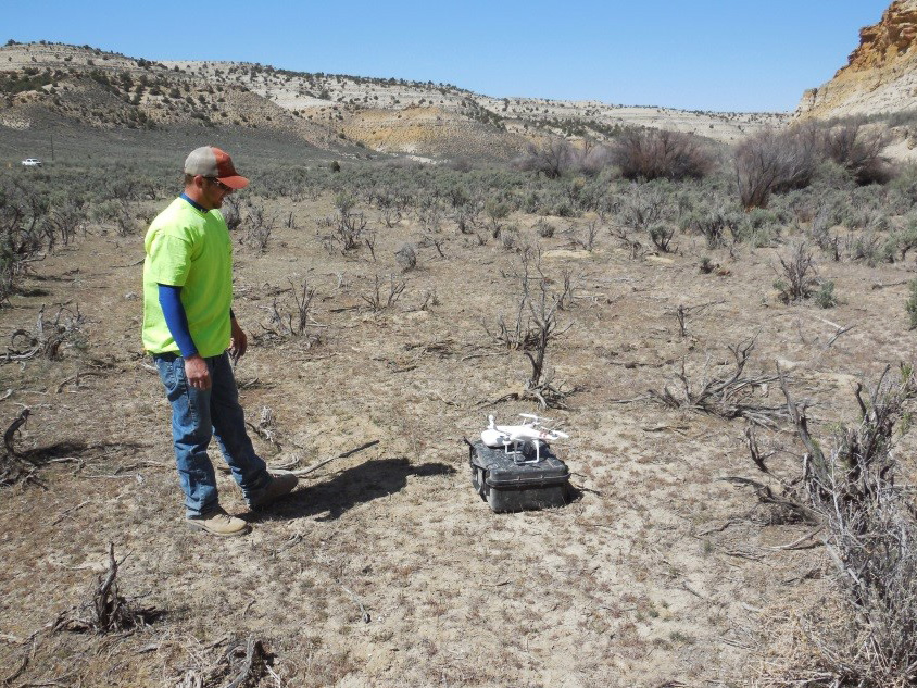
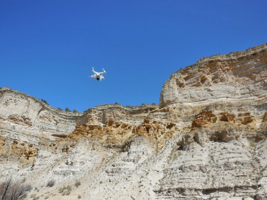
Drone technology represents another cutting edge method for studying surface geology. Preliminary imaging of hoodoos in southern Utah and the Green River Formation in eastern Utah has been undertaken and a number of future projects are in the planning stages.
 |
 |