
Potential Student Projects
Rift Basin Sedimentary Architecture
Sedimentary facies and architecture directly reflect the tectonics, climate, and source catchment character of the basins in which they form. Deciphering the relative influence of these controls in ancient sedimentary basins relies on rigorous understanding of modern or geologically young analogs. Quantitative assessment of these controls is coming to the forefront of sedimentary research through detailed field studies coupled with state-of-the-art numerical models. The modern eastern Great Basin of the western United States is an active continental rift setting with unparalleled geologic, tectonic, and topographic databases that has undergone a major transgression and regression since the Late Pleistocene. It is thus an excellent natural laboratory for quantifying the relative role that tectonics, climate, and catchment characteristics play in controlling sedimentary architecture. The completed research will point the way for future, more sophisticated source-to-sink studies of classic sedimentary basins.
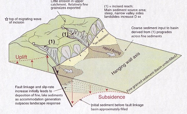 |
Synthesis diagram of erosional and depositional patterns of footwall catchments and hanging wall basins (Whittaker et al., 2010). |
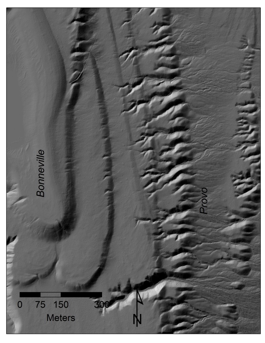
Lake Bonneville
Dr. Jewell and collaborators such as Jack Oviatt (Kansas State University) have been working on Lake Bonneville for nearly two decades. Recent work has emphasized understanding the transgressive “Intermediate” shorelines between the Bonneville and Provo shorelines. A number of interesting scientific issues remain to be resolved. Of particular interest is the Late Pleistocene/Holocene transition when the climate transition had created two separate lakes (Lake Gunnison and Lake Gilbert) connected by a river (the “Old River Bed). The river delta was the site for some of the first human occupants in the Great Basin.
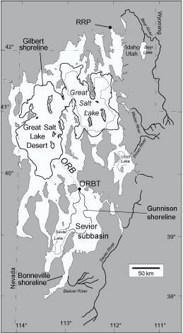 |
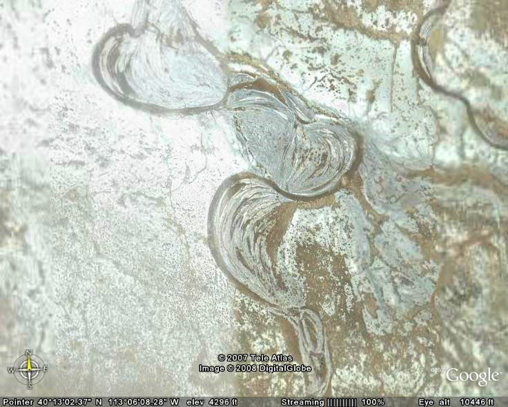
Location map of Lake Gunnison, Lake Gilbert and the Old River Bed (ORB) (left). Scroll bars of the Old River Bed Channel (below) |
 |
Tectonic and Climatic Control of Alluvial Systems
Subtle features are often revealed by the patterns of alluvial systems and their associated sedimentary features. Tectonically active areas along the Wasatch Front and throughout the Intermountain West present a variety of potential projects for prospective students. For instance, Holocene incision rates since the regression of Late Pleistocene Lake Bonneville can now be characterized with high-resolution LIDAR data sets but the relative control of climate and tectonics is poorly understood. Dr. Jewell is also doing preliminary work in the central Idaho batholith.
 |
This spectacular set of spits in the Deep Creek Mountains of western Utah show highly differential erosion patterns between the Bonneville and Provo shorelines |
Modern Alluvial Systems
The Department of Geology and Geophysics recently acquired a Phantom 3 quadcopter and high resolution camera that can be applied to a number modern alluvial settings. For instance, flash floods are extremely important geomorphic agents, yet witnessing and measuring a flashflood is nearly impossible. An alternative method would involve using high resolution photography to document the “before and after” of a flash flood channel. Initial surveys of multiple alluvial channels in central and southern Utah will be undertaken in the spring of 2016.
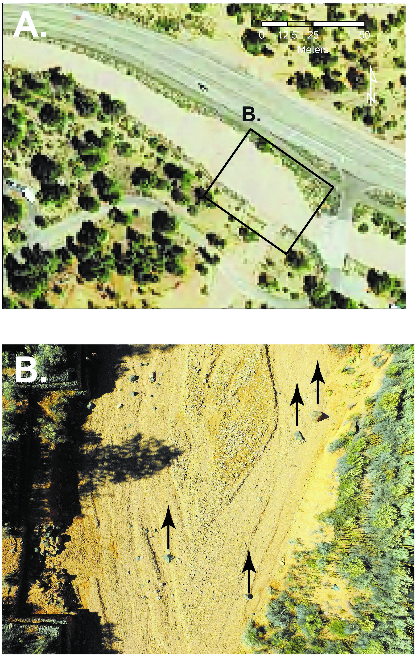 |
A. Alluvial channel in Red Canyon, Garfield County, Utah. NAIP 1-m resolution aerial photography.
|
| B. Detail of the same channel from photograph by a Phantom 3 drone. Details of channel morphology from the latest spring runoff or flash flood are clearly visible as a number of large boulders. By tracking movement of various-size boulders over several years, the intensity of stream discharge can be back calculated. |
The technology might also be effectively applied to understanding the stability and evolution of historic mining activity in the western United States.
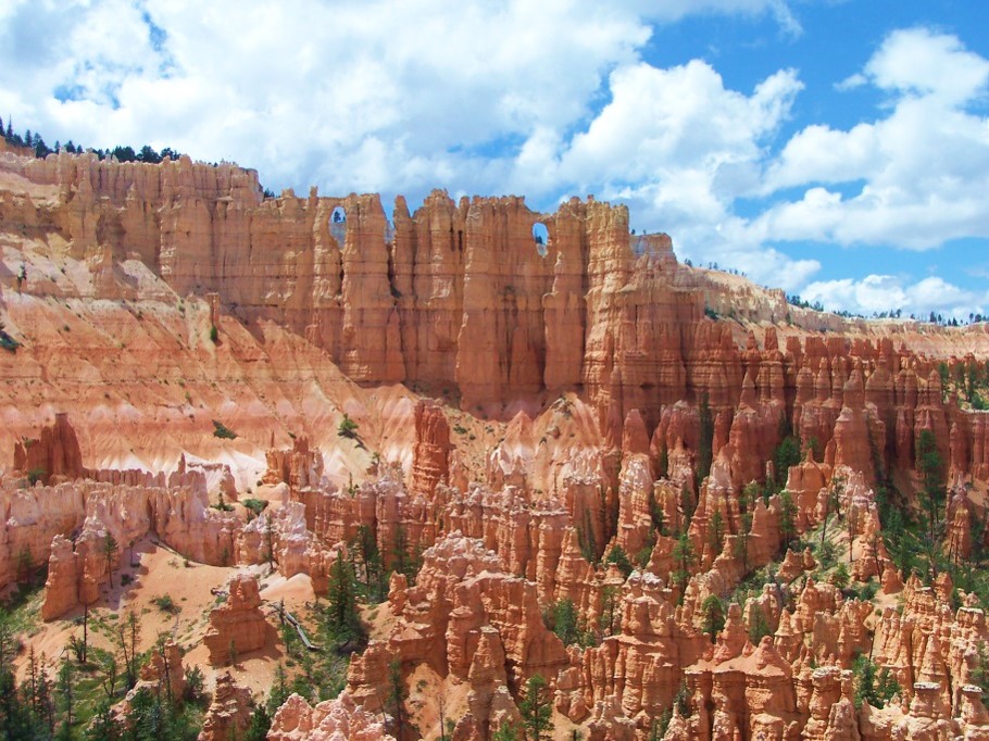
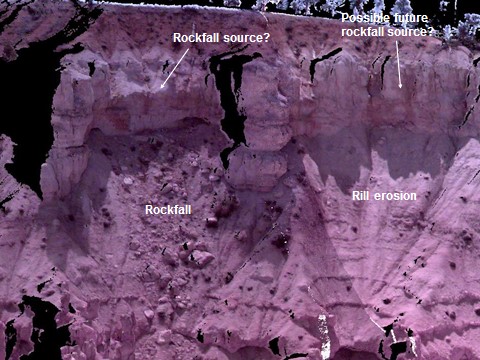
Bryce Canyon Geomorphology
A terrestrial lidar survey of selected locations in Bryce Canyon National Park was conducted in 2009. These data have yet to be thoroughly analyzed and there are good possibilities for additional data acquisition and investigations in the future in this spectacular setting.
 |
 |